Flood Control Facilities
Flood control is typically divided into structural and non-structural activities. Structural methods include large infrastructure, levees, and regional detention facilities, as well as local stormwater management systems such as detention basins, storm sewers, and infiltration basins. Non-structural activities include flood fighting, floodplain mapping, stream maintenance, floodplain regulations, and comprehensive and land-use planning.
Structural Flood Control
While there are no large or regional structural flood control facilities along the main stem of the Fox River, there are countless public and private stormwater detention basins throughout the watershed. Since the 1980’s, stormwater management ordinances require many new developments to construct detention basins to reduce and detain stormwater runoff. This requirement is generally triggered by either development size, disturbed area, or new impervious area. The detention basin can provide local flood relief.
Stratton Dam
Due to the gate control structures at Stratton Dam, the dam is often erroneously considered to be a flood control structure. The ISWS study of alternative operation scenarios showed that removal of Stratton dam would have the best benefit for flood reduction. However, a complete dam removal would only reduce the water surface elevations upstream of the dam less than 6 inches in only extremely large flood events and would have no benefits to the Fox River downstream of Stratton Dam. Removal of Stratton Dam would not eliminate flooding but would reduce or risk elimination of the recreational and boating opportunities and the natural resources throughout the Chain of Lakes and Fox River watershed during periods with less rain. The impacts would extend to the local economy.
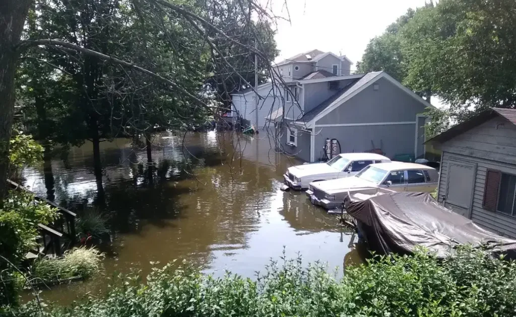
Flood Fighting
Communities along the Fox River main stem commonly implement sandbagging practices to protect homes and businesses. Floodwalls made of plywood and plastic are also deployed. This type of flood protection requires sufficient time to prepare and construct the sandbag wall. Nunda Township in McHenry County supplies thousands of sandbags to the residents along the Fox River during flood events. In 2017, the township reported filling 100,000 sandbags requiring 1,170 volunteer hours to complete. It takes an average of 600 sandbags to cover a 100 foot section, 1 foot high.
Floodplain Mapping
Federal Emergency Management Agency (FEMA) manages the National Flood Insurance Program (NFIP) and provide the Flood Insurance Rate Maps (FIRM) that delineate base flood elevations and flood risk zones. The NFIP provides flood insurance to property owners, renters, and businesses, and having this coverage helps them recover from a flood event . The NFIP works with communities required to adopt and enforce floodplain management regulations that help mitigate flooding effects.